
NRCS has soil maps and data available online for more than 95 percent of the nation’s counties and anticipates having 100 percent in the near future. The site is updated and maintained online as the single authoritative source of soil survey information.
On October 20, 2015,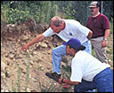 the USDA-Natural Resources Conservation Service (NRCS) updated soil data for 2,706 soil survey areas. Each soil survey now contains a full complement of national interpretations giving users the ability to analyze interpretations regionally, multi-state or across the United States.
Web Soil Survey (WSS) provides soil data and information produced by the National Cooperative Soil Survey. It is operated by the USDA Natural Resources Conservation Service (NRCS) and provides access to the largest natural resource information system in the world.
Soil surveys can be used for general farm, local, and wider area planning. Onsite investigation is needed in some cases, such as soil quality assessments and certain conservation and engineering applications. For more detailed information, contact your local USDA Service Center or your NRCS State Soil Scientist.