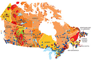
source: http://www.centreforenergy.com
There is a nice interactive map of US energy: sources, transmission lines, etc. Click on your state at http://www.eia.gov/state/maps.cfm
Here’s a map for Canada, that shows the energy sources http://www.centreforenergy.com/FactsStats/
Questions:
What lines or sources are near you?
How do they or could they affect your operation?
